Contact Us
The Regency Town House
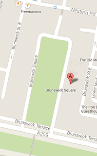
13 Brunswick Square
Brighton & Hove
East Sussex
BN3 1EH, UK
Sign up for our Newsletter
Our monthly newsletter lists our upcoming events, reviews, news from the Town House, history features and snippets, plus a local exhibition listing.
Lower Market Street
Market Street in the mid-1980s. Courtesy of the Regency Society (James Gray Collection)
Lower Market Street is a relatively small street sitting directly south of the Old Market and nestled between Waterloo Street and Brunswick Street East. The street, along with Upper Market Street appears on C.A. Busby’s 1825 Plan for Brunswick Town where they are jointly labelled as Market Street. Lower and Upper Market Streets are separated from each other by the Old Market; Upper Market Street being directly north of the market. At the southern end of Lower Market Street access is via an east to west branch creating an overall ‘L’ shape to the street (see image 1).
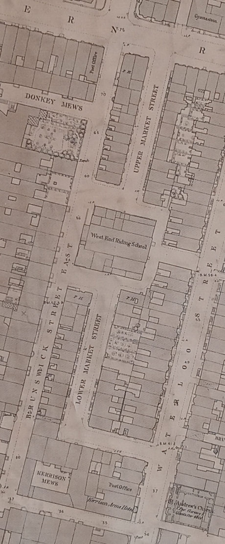
Image 1: Extract from the 1875 Ordnance Survey map showing Lower and Upper Market Streets
Lower Market Street is a working-class residential street and lacks the stable blocks seen in the other working-class streets such as Brunswick Street East and Brunswick Street West. The 1841 census records the street as Market Street. By this date the western side of the street has a number of completed and occupied houses, numbers one to ten. The eastern side is less developed with only numbers 34-35 and 48-49 recorded. It is interesting to note that number five no longer exists as a house number and last appears in the street directories in 1919 when it is listed as a ‘motor works’. The first time that the street is listed in the Street Directories is 1848 when 12 houses are listed.
The street directories and census suggest that by 1851 only one additional house had been built, number 36. A total of 43 households are listed in the 1851 census at 14 addresses with the total number of individuals listed living in the street being 151; this reflects the multiple occupancies of the houses in this street. The 1851 census also records that three houses are being built on the west side of the street. The 1861 census has 51 households recorded with a total of 201 individuals being listed. Overcrowding is clearly evident; for example, house numbers seven and 48 have 18 occupants each and, by contrast, house number five only lists two. New house numbers include 11 to 15 and 46 and 47.
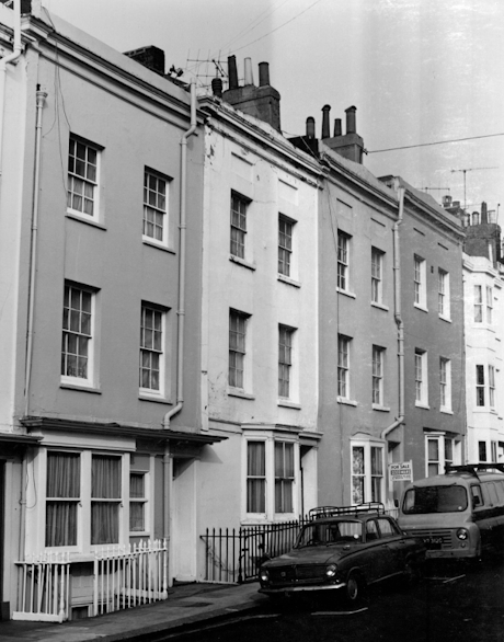
Image 2: Numbers 7 to 10 looking north in 1975.
Source: Planning Department photographs of buildings in the Brunswick Town conservation area. The KEEP
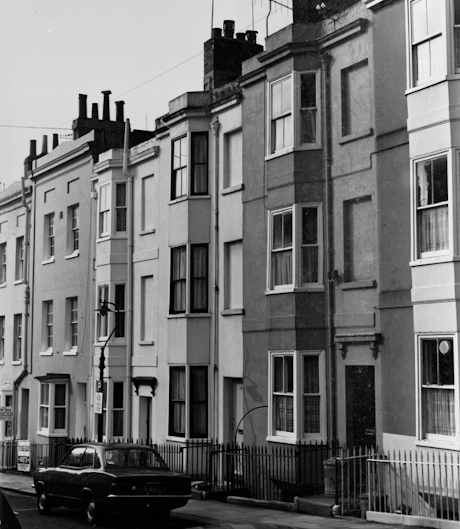
Image 3: Number 11 to 13 looking southeast in 1975.
Source: Planning Department photographs of buildings in the Brunswick Town conservation area. The KEEP
By 1871 the census records 53 households with a total of 219 individuals living in the street. House numbers 16 and 45 have now been added to the list.
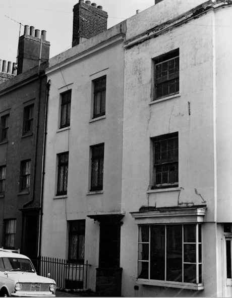
Image 4: Number 48 and 49 looking east in 1975.
Source: Planning Department photographs of buildings in the Brunswick Town conservation area. The KEEP
Numbers one and two and six to ten (including railings) are grade 2 listed buildings with six to ten listed primarily because of their special architectural and historic example of mid-1820s terraced properties. Both sets of buildings were listed in 1981 and 1971 respectively.
The houses on the east side of the street, numbers 34, 35, 36, 44 and 45, generally have a lower density of individuals listed in the census data. By 1901 these houses are being occupied by single families.
A sample of occupations of residents listed in the 1861 census include: sergeant of police, policeman, beer seller, groom, stable keeper livery, whitesmith, ostler, hair dresser, painter, coachman, builder, labourer, saddler, laundress, invalid chairman, waterman, porter, jobbing mason, milliner, fly man, marble man, charwoman, tailor, nurse, servant, servant butler, footman, carter and gardener.
Birth places listed within this street in the 1861 census include: Brighton, Hove, Hampshire, Berkshire, Somerset, Gloucestershire, Middlesex (London), Essex, Surrey, Kent, Oxfordshire, Warwickshire, Wiltshire, Leicestershire, Worcestershire, Norfolk, Wales, Scotland and Ireland.
No shortage of places to drink!
Considering that Lower Market Street is a small residential street there was no shortage of public houses and beer houses. The establishments and their approximate dates according to the street directories are:
Number 3: The Horse and Groom; possibly since 1832 to 1906. From 1949 to 1968 the street directories list number 3 as the ‘Imperial Garage’.
Number 10: The Market Inn 1866 to 1931
Number 14: 1865 to 1878
Number 16: The Conqueror Inn 1867 to present (now, since 2015, the Bottoms Rest)
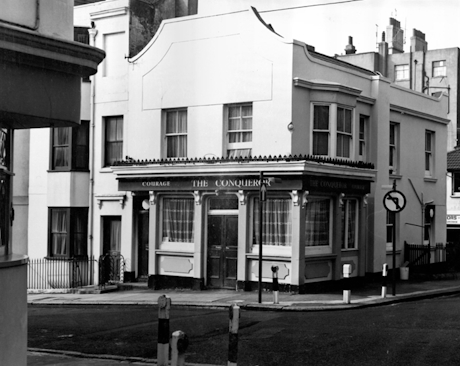
Image 5: The Conqueror looking west 1975.
Source: Planning Department photographs of buildings in the Brunswick Town conservation area. The KEEP
Number 34: Hero of Waterloo 1854 to 1901
Number 35: The Carpenters Arms 1852 to 1894
Drama and tragedy in Lower Market Street
The Lincolnshire Chronicle 31st March and The West Surrey Times 1st April 1882 both report on a storm which ‘was felt all over the country late on Saturday night, and early Sunday morning’. Unfortunately, the storm resulted in a fatality at number 36 Lower Market Street when ‘several stacks of chimneys were blown down’ falling on and causing the roof to collapse into two bedrooms on the top floor. Rescuers found the body of 72-year-old Harriet Marsh in the front room. A couple in the rear room survived but were covered in rubble and had difficulty extricating themselves from the room.
The Brighton Argus of 12th May 1899 reports on an incident which had occurred the previous day where a resident, James Lewer, of 34 Lower Market Street was injured when attempting to stop a horse which had bolted. The dog cart the horse was pulling had collided with a bus belonging to the Brighton, Hove, and Preston Omnibus Company, the accident happening opposite Oriental Place. James was struck on the face by the wing of the cart which then proceeded to pass over his right leg. Fortunately, he escaped any fractures though had a deep wound to his face and contusions to his leg. To add to the chaos a second horse pulling a cab took fright and bolted joining the first horse galloping westward.
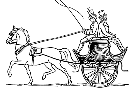
Image 6: A dog cart.
Source: Archives of Pearson Scott Foresman, donated to the Wikimedia Foundation
A similar incident, with a more tragic outcome, had occurred in Lower Market Street itself in 1892 and was reported in the Hastings and Bexhill Independent on 12th May 1892. William Trevett an 18-year-old farm labourer was in charge of a horse and cart in Lower Market Street when it bolted. Sadly, he fell whilst running alongside the cart, the cart running over him causing injuries which resulted in his death. At the inquest a verdict of ‘Accidental Death’ was returned.
The Brighton Argus reports on 14th August 1899 on another horse incident occurring in Lower Market Street. George Debenham a 29-year-old stableman was charged with being drunk in charge of a horse after being spotted in Little Western Street displaying little control over his horse. The police were called and the constable in attendance, P.C. Beere, caught up with the rider and horse in Lower Market Street. P.C. Beere, who charged him, described what he saw: ‘The animal was repeatedly backing onto the pavement, and the prisoner had great difficulty in keeping his seat’. At his appearance at Hove Police Court, he pleaded ‘not guilty’ claiming that the horse was ‘very fresh’. He was fined 11s 6d or seven days imprisonment.
Horses were not the only thing to create a disturbance in Lower Market Street. The Brighton Argus reports on 11th March 1912 of an incident involving children playing in the street. James Bampton of 13 Lower Market Street was arrested after being accused of common assault involving seven-year-old Nellie Bartlett of Brunswick Street East. It was alleged that whilst playing a game called ‘He’, which required her to touch a piece of wood, she had kicked the front door of number 13 twice causing James to come out of his house to chastise her. It was claimed that James chased her and kicked her in the right hip when she fell. After hearing testimonies from other children present and various witnesses it was reported that ‘The Mayor said they thought defendant lost his temper because of the annoyance received, and committed the assault. He would be fined 25s., including costs, or 7 days’.
Ongoing development of Lower Market Street
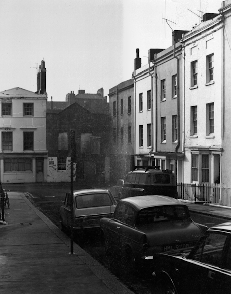
Image 7: Number 3 Lower Market Street on the left of the picture prior to its demolition in the 1970s.
Source: Scrapbook of pubs in Hove c1975-c1990 The KEEP
Number 3 which had been the Horse and Groom and then listed as the Imperial Garage was demolished, alongside the adjoining warehouse building, in the 1970s. It was replaced by a complex of 18 one-bedroom flats for people over the age of 60. Built in 1981 the complex covers the area marked as Kerrison Mews at the southern end of the street on the 1875 Ordnance Survey map. Today the complex is called Kerrison Mews but rather confusingly at the north end of Lower Market Street is a small street running between Brunswick Street East and leading to the arch onto Waterloo Street which is also named Kerrison Mews.
The ordnance survey map of 1875 (image 1) shows four adjoining vacant plots of land on the east side of the street, three of which are now occupied by house numbers 37, 43 and 44. Number 44 first appears in the street directories in 1889 and has the typical appearance of a late Victorian terraced house.
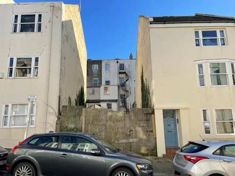
Image 8: Plot of land between house numbers 37 and 43 Lower Market Street.
Source: Brighton and Hove News January 2nd 2025
Numbers 37 and 43 appear to have been built sometime after 1974. The facades are plain and lack any distinctive architectural features.
In January 2025 it was reported that the remaining plot of land had been purchased in 2024 and that a planning application had been submitted for the construction of a four bedroomed house. The Argus reported on 6th January 2025 that in the planning documents, Talbot Developments said ‘the proposed development will “help to repair” the “unloved and untidy” appearance of the site and surrounding area’, which the developer said was caused by the creation of numbers 37 and 43. Planning documents said the additions were a “poor match” for the original development and said the street resembled a “smile with a missing tooth”.
In the planning documents it states that the ‘site has been vacant for many years’ and that it is not clear what the previous use of the site was. The applicant states that it could possibly be a bombed site, and that it is boarded up and it is assumed that historically the terrace would have been complete. No evidence has been found in the preparation of this report to support any of these suggestions. Rather the empty plot has always been an empty plot and is a reflection of the piecemeal development of the east side of the street; something which is seen in the varying styles of the facades of the houses on that side of the street.
Research by Thomas Aird, February 2026