Contact Us
The Regency Town House
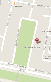
13 Brunswick Square
Brighton & Hove
East Sussex
BN3 1EH, UK
Sign up for our Newsletter
Our monthly newsletter lists our upcoming events, reviews, news from the Town House, history features and snippets, plus a local exhibition listing.
1870s Town Plans of Brighton
A Rescue Mission for Old Town Plans
We have been given two boxes of old town plans by an archivist at Brighton City Council. Our local historic record repository at The Keep already had copies of these, so they were offered to us to explore and interpret.
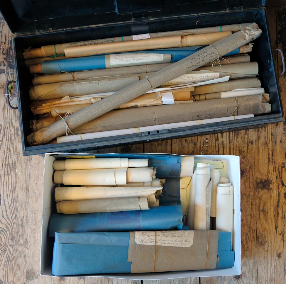 Lots and lots of old town plans
We first thought they might be old sanitation plans, showing routes for sewers and drainage. Having carefully unrolled a few of the sturdier plans, closer examination suggests they were produced by surveyors to update the Ordnance Survey.
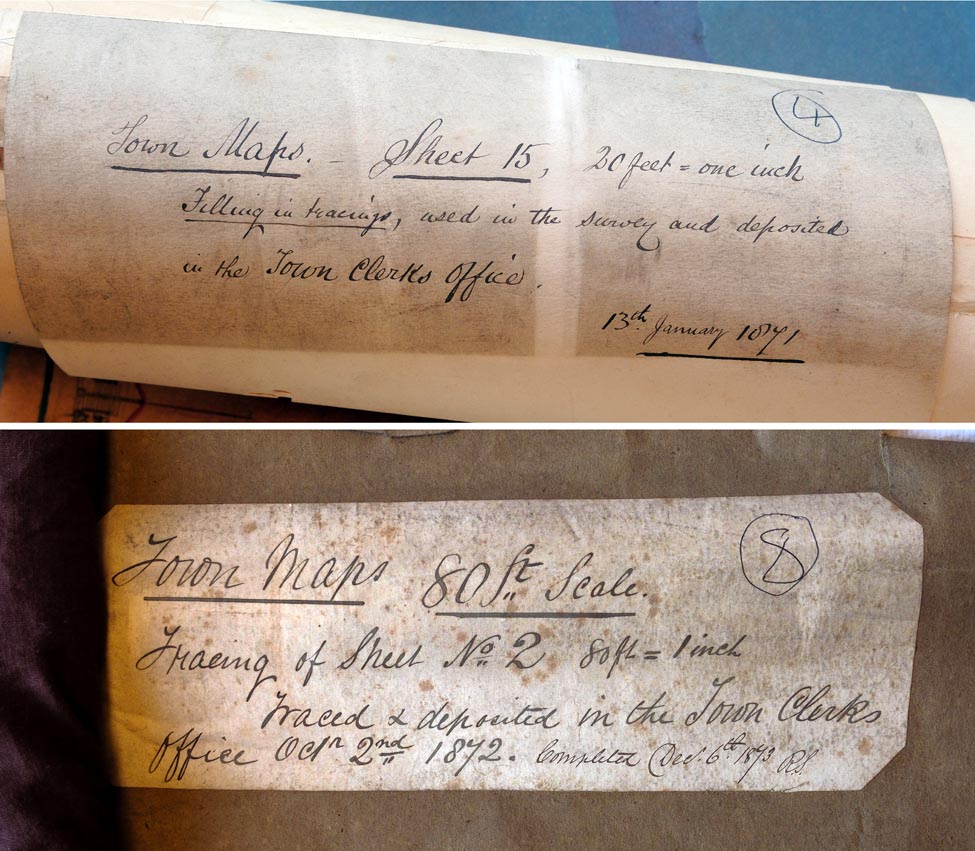 The town plans date from the early 1870s and are drawn to either 20 feet to the inch, or 80 feet to the inch.
The smaller scale plans are on a very thin and extremely fragile brown tracing paper, while the larger scale plans have been bonded to a stronger backing paper to enable old features to be cut out and new ones drawn and stuck onto the original to update it. As can be seen from the pictures, they include quite extraordinary detail, including individual flower beds… a truly fascinating find!
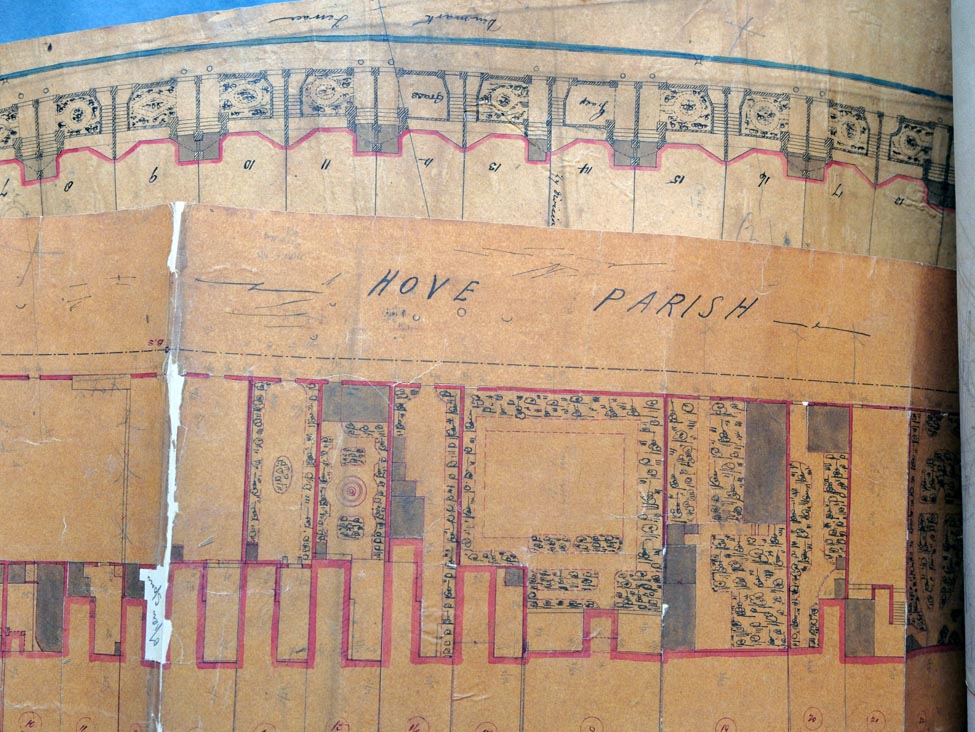 Even the flower beds were recorded.
Some of the plans are so frangible that they would simply fall apart if unrolled. With this in mind, advice is being sought from a specialist paper conservator as to how to treat them so they can be safely unrolled, recorded, catalogued and exhibited.
The first task has been to tease them out of hibernation: gently unrolling the sheets after humidifying and pressing them down to remove their tendency to immediately roll up back up again like a pangolin. This takes plenty of time and patience.
Here are details from two of the plan sheets.
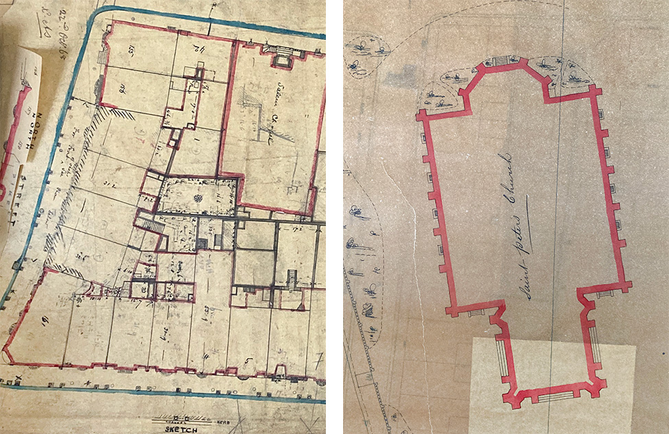 Details from two town plans - drawn to the same scale but photographed at different magnifications.
In the plan on the left one can see four empty housing plots on the north side of North Street, between Bond Street and New Road. Also visible on Bond Street (outlined in red) is the Salem Chapel, now gone.
The plan on the right shows the original outline of St Peter's Church, as designed by Charles Barry and built 1824-28. Less than 20 years later, the apse to the north was demolished to make way for a much larger chancel. Today we can clearly see the Barry structure is in pale Portland Stone and the 'newer' part in a much warmer Sussex Sandstone.